Volcan Acatenango Hike
This past weekend’s hike up Acatenango, the third tallest volcano
in Central America, was vastly different from the excursion two weeks ago to
Volcan Atitlan. For a start, the group
was larger, with 13 people in our group.
Also, we went with a tour company—Old Town Outfitters—and therefore had
4 other people in our group, 3 bilingual guides, and 6 local men to carry extra
gear (bringing our group’s total number to 26 people). And, it was an overnight trip, which meant we
didn’t hike the entire distance on Saturday, nor did we have to start before
dawn. It also meant we were wearing
backpacks and carrying more weight than at Atitlan.
Still, and I may be crazy, but I think Acatenango was a
little easier than climbing Atitlan.
Maybe it’s just that the first hike did its job as a training run and
strengthened my uphill climbing muscles.
Maybe it was my mindset. Or maybe
it was the fact that we were in a large group and the guide paced us, stopping
periodically to wait for the rest of the group to catch up.
By the time we drove to Antigua to pay at the outfitters’
shop, then took a group van to the trailhead and divvied up sleeping bags and
pads, we were finally starting on the trail at around 10:30am. The hike is divided into four sections. It starts with a steep uphill climb through
farmland, then enters a cloud forest where it switchbacks up to the lunch
spot. From there, the path levels out
and enters a sparse pine forest. We
walked around the mountain to get to our campsite for the night. The next morning, we tackled the final stage,
a steep uphill climb through volcanic
rock and sand to reach the summit at the volcano’s crater.
We made good time on the hike up—at least according to our
guides. We reached the lunch spot at
about 12:30pm, approximately 1-2 hours ahead of schedule. There, we relaxed (and donned extra layers as
the clouds and elevations were combining to create a chill) while the guides
prepared a lunch of tacos: tortillas, black beans, guacamole, tomatoes, peppers,
onions, and chips. We topped off the
meal with Chiky cookies and butter toffee candies.
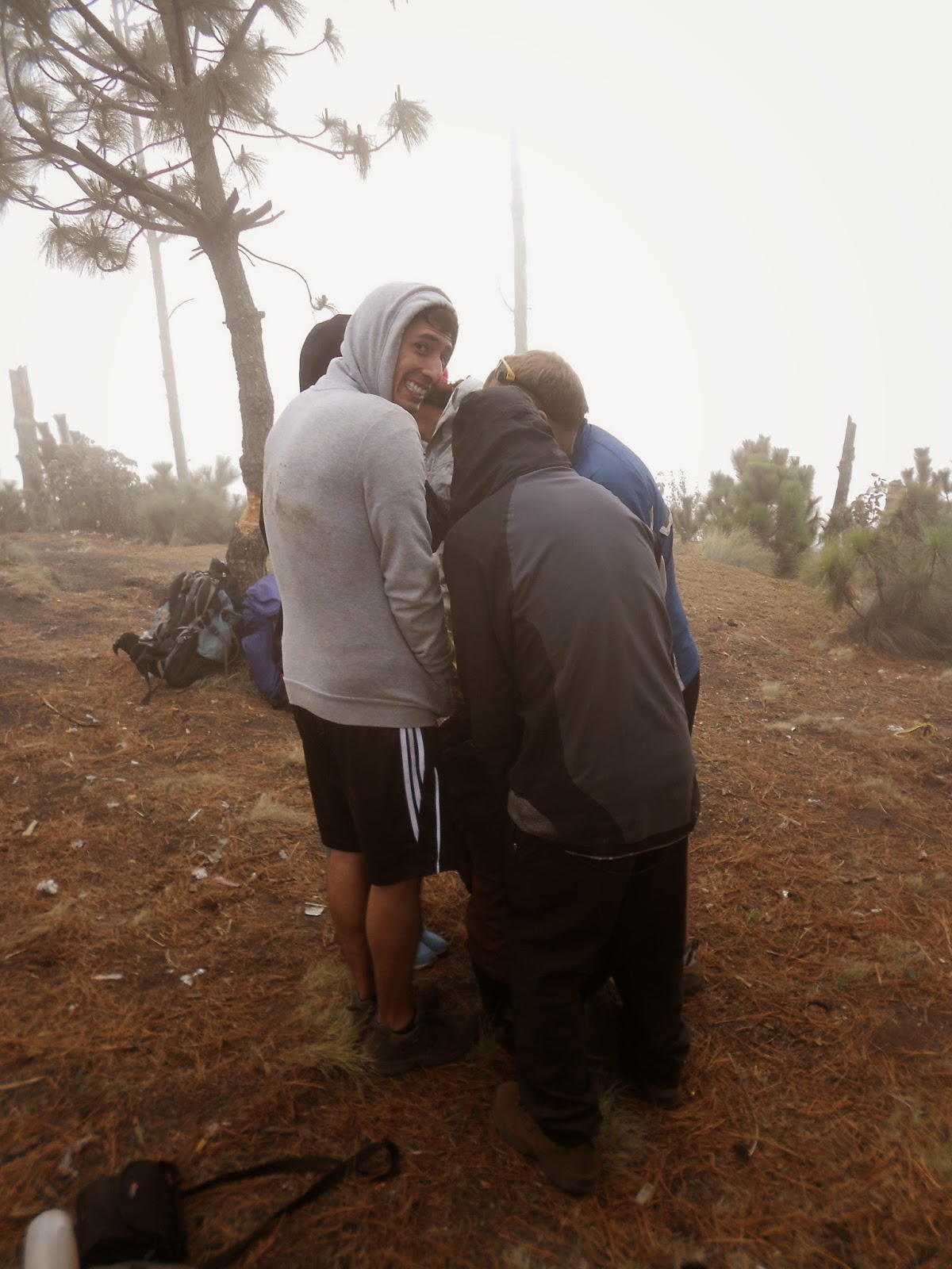 |
| Group huddle after lunch to keep warm. |
Then we continued onward for just under 2 hours, reaching
the campsite at 3:30pm. Amy, Carrie, and
I unpacked our tent and added more layers as the temperature kept dropping (we
were at about 11,500ft at this point) and snuggled into our sleeping bags for a
quick nap before dinner. The clouds
outside were still thick, and we couldn’t see anything beyond our own
campsite.
After about half an hour of dozing, I went outside and
joined a group of people around a fire that did a great job of keeping us
warm. After a while, some of the clouds
blew away, and we were rewarded with great views of Volcan Fuego, one of the
most active volcanoes in Guatemala, only 4km away. As darkness fell, we hoped the clouds would
stay away and Fuego would give us a pyrotechnics show with bright red lava, but
no such luck for us.
 |
| fuego y Volcan Fuego. :) |
 |
| "sunset" over Fuego |
At 7:30, dinner (pasta with vegetables) was ready, and after
that, everyone decided it was time for bed.
Now, in my particular tent, the zippers on the door were not
functional. Not just like they stuck
when closing. Like, they didn’t zip
closed at all, so we had to strategically decide where to position the 2
zippers to sort of hold the tent door closed.
Amy and Carrie and I were pretty worried we’d be facing a frigid night. We rigged up a wind-blocking system of sorts
by placing my pack in front of the door and hanging Carrie’s raincoat from the
ceiling. And remarkably, between my
layers (3 shirts, a sweatshirt, leggings and pants, and 2 pairs of socks) and
my rented sleeping bag, I stayed plenty warm throughout the night.
 |
| defunct zipper |
After going to bed at 7:30pm, though, I almost welcomed our
4am wake-up time. There’s only so much
time a person can sleep in a tent.
Sadly, as we woke with the plan of summiting for the
sunrise, we found we were still clouded in.
Still, since we’d packed up our tents and going back to bed wasn’t an
option anymore, we decided to go for it.
We took off in the darkness at around 5am.
I’m actually really glad we underwent this part of the trail
in complete blackness. It kept me from
stopping to look around and realize how steep the trail was, how little there
was to hold onto if I were to fall backwards.
Instead I concentrated on the ground in front of me—trying to place my
feet where the person before me had stepped, because the sliding rock/sand was
more stable there and less likely to slip under me.
When we reached the top, we were still in the middle of a
white cloud. Off in the distance, we
caught a faint yellow glow of a sunrise, but we could see no details. At the highest point, the wind whipped icy
air at us making it difficult even to stand.
We were soaked with condensation, cold, and we couldn’t see more than
the black rock and each other. We were
offered the option of walking around the crater—perhaps a 10 minute walk—but
unanimously decided to go back down to camp instead.
 |
| Amy and Fabian at the top |
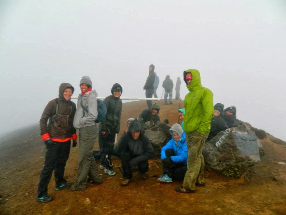 |
| At the highest point of the climb. Zero view. Photo credit to Lucas Rank |
I’m glad we made the trek to the highest point—an impressive
13,045ft (3976m). I do wish we’d been
able to enjoy a nice view. But the
fulfillment of having done it is enough.
The way back down to the campsite was much less scary than I
had anticipated—and much, much easier
than going down the part that’s above the treeline at Atitlan. Because the sand/rock was so loose, we could
run down it, our feet sliding a bit with each step, but keeping totally in control. What had taken us over an hour felt like it
took about 15 minutes to come down.
 |
| Down the slope...into the cloud. Photo credit to Lucas Rank |
From there, we had breakfast, dried out a bit around the
fire, then headed back down the mountain.
We took a slightly different route down—a bit steeper, but easy enough
on the downhill—and made it back to the trailhead by 10:00am (just over 2 hours
down! Wow!). From there, we made a
beeline first for Antigua to recover our cars, and then home for a hot shower. I feel like I may be finding black sand in my
ears and nose for days yet, despite the scrubbing I’ve done.
But it was worth it.
What a trek!
 |
| The whole group at the bottom Photo credit to Lucas Rank |


Comments
Post a Comment